Land east of Knowsley Lane
Knowsley Village
Background
The Site
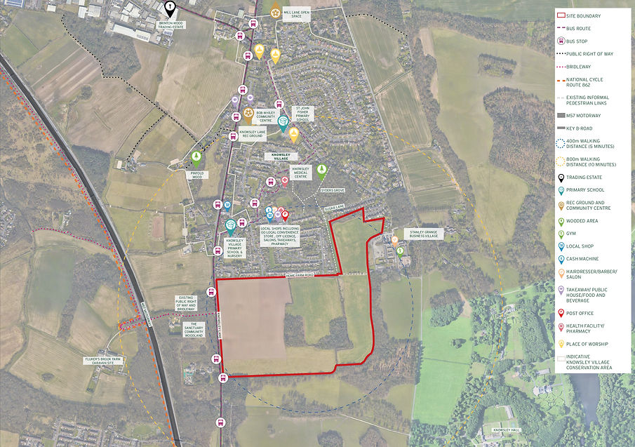
The site is situated to the south of Knowsley Village, within the borough of Knowsley. It is bound by Knowsley Lane (B5202) to the west, Home Farm Road and properties on Sugar Lane along its northern extents, and Knowsley Estate to the east and south. The site is well contained by hedgerows and tree planting on all sides.
The site comprises 33.8 hectares of land in multiple field parcels divided by hedgerows, with two wooded areas in the centre. The site is predominantly flat and is not subject to any landscape or environmental designations.
In respect of the surrounding area, the houses to the north of the site, beyond Home Farm Road, are predominantly red brick, semi-detached, two storey homes. To the east and south are the grounds of Knowsley Hall Registered Park and Garden (including Stanley Grange Business Village to the north east) which are divided from the site by a varied woodland area and lines of trees.

Site Location Plan
Planning Context
The site was released from the Green Belt within the 2016 Knowsley Core Strategy and designated as ‘safeguarded land’ to meet future development needs. This safeguarded land designation includes this site and further land wrapping around the settlement to the north east, to the east of Ormskirk Road, with the full site area considered capable of delivering 1,093 homes.
Knowsley Council’s housing requirements have increased significantly under the latest government calculations, from 450 dwellings per annum (dpa) in the adopted plan to 608 dpa, an uplift of 35%. Therefore, the Council are under increasing pressure to deliver suitable housing sites in Knowsley to maintain an ongoing 5 year supply of housing, as required by government, to avoid more speculative development from
coming forward.
This site represents an entirely logical choice for an application at this time to support the Council’s Housing Land Supply given the wider site is the only undeveloped greenfield land that has been specifically identified to meet the future development needs of the Council having been released from the Green belt within the 2016
Local Plan.
Knowsley Council are in the process of reviewing their Local Plan because it is now more than 5 years old. This process will require them to release significant additional housing land to meet development needs for the next 15-20 years, given that their current supply has been largely exhausted. Therefore, as outlined above, given this site has already been identified to help meet the future development needs of the Borough, it represents an entirely logical choice for an allocation within the emerging Knowsley Local Plan. Further, it also has the potential to meet the needs of the wider City Region and its emerging Spatial Development Strategy, with its excellent transport connections and strategic location on the edge of the Liverpool urban area.
Hallam Land have been actively promoting the site on the above basis, however, the Local Plan is still in its early stages and some years from adoption, whilst there is an existing and continued need for this site to start delivering. For this reason, pre-application engagement with the Council has indicated support for an Outline Planning Application to be submitted in the near future.
Due to the 2-3 year lead-in times associated with this application process (gaining outline consent, marketing and selling the site to one or more housebuilders, achieving detailed Reserved Matters consent and discharging associated planning conditions); the intention is to submit an Outline Planning Application during Summer 2025, allowing delivery to begin in 2028 to help meet identified housing needs.
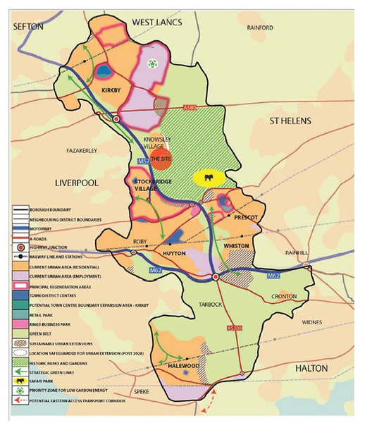
Knowsley Key Diagram
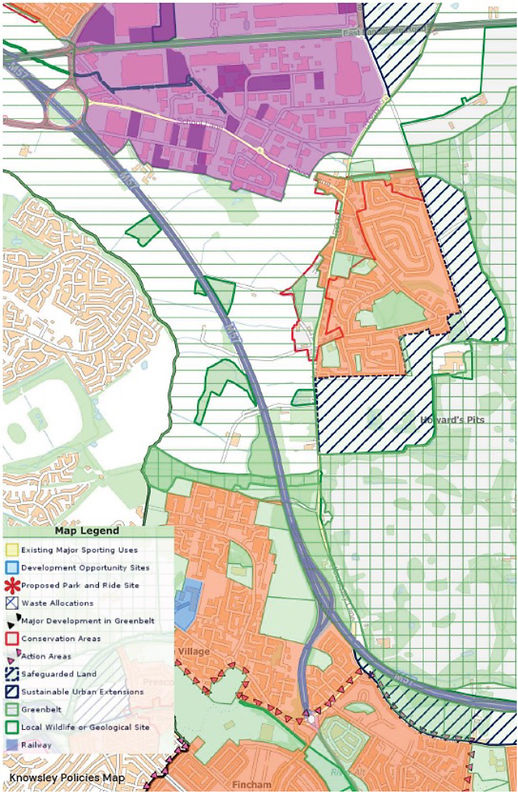
Knowsley Council Local Plan & Policy Map

Site Sustainability
The site is extremely well connected to Knowsley Village, with direct vehicular access proposed via Knowsley Lane, and multiple pedestrian and cycle links from the north of the site, including routes through Ross Close Playing Fields and Syders Grove wooded area. In terms of local bus stops, there are three adjacent to the site including Shannon’s Lane on both sides, Croxteth Lane and Sugar Lane. At Shannon’s Lane bus stop, service 217/217A leaves for Huyton every 30 minutes and the 297 leaves for St Helens every 2 hours.
The nearest train station is Prescot, located 4km to the south of the site with connections to Liverpool Lime Street in 22 minutes and Manchester in 70 minutes. Beyond that is Whiston and Eccleston Park railway station with connections to Warrington in just over 1 hour and Liverpool Lime Street in 25 minutes.
The site is well served in terms of schools, with 2 primary schools, and a nursery located within walking distance. There are also 2 secondary schools, including Meadow Park School and The Prescot School which are located within 3km of the site.
In terms of local amenities there is a parade of shops on Sugar Lane within 400 metres (5 minute walk) of the site including a Go Local convenience store, pharmacy, off license, takeaways and hairdressers; with Knowsley Medical Centre a further 150 metres north off Frederick Lunt Avenue.
Other amenities within Knowsley Village include a church, public house, recreation ground, community centre, along with several recreation areas including Syders Grove, Pinfold Wood and Mill Lane Open Space.
Accordingly, the site benefits from a good location in relation to existing services in the local area.